What IS The Sustainable Gardening Library? Part 5 of 5

Why is the EcoRegions app important?

Most homeowners who’ve dabbled in gardening have heard of the USDA Plant Hardiness Zones, which tell us the average minimum temperature range for where we live. There are a total of 26 zones and sub-zones; 12 of them generally appear on plant labels to help us determine whether a plant we want to buy can survive the winter in our zone. But plant hardiness is only one of multiple factors that determine whether a plant will thrive in any particular garden. Others include soil type, climate, terrain, natural vegetation, and how rivers, streams, and similar water features flow through the landscape. The Environmental Protection Agency has codified this information, gathered from several different Federal agencies, into nearly 200 categories called Ecoregions.
What Is the Sustainable Gardening Library EcoRegions app?
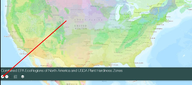
The EcoRegions app is a an online tool that combines the USDA Plant Hardiness Zone Map with the EPA North American Ecoregions Map into a single, interactive GIS application.
It’s simple and easy to use:
• Both maps scale, so you can zoom in to street level.
• The map layers toggle on and off, so you can look at them separately or together.
• Each map legend can be expanded for further detail.
• Linked popups provide both ecoregion and hardiness zone.
• A link in each ecoregion popup connects you to the complete pdf of North American Level III Ecoregion descriptions.
Top Tip: To narrow results, zoom in to a location before activating a popup.
LINK TO THE ECOREGIONS APP NOW
Tutorial: How to use the Sustainable Gardening Library EcoRegions app on a computer
1. Click on the EcoRegions button on the Library’s Home Page.
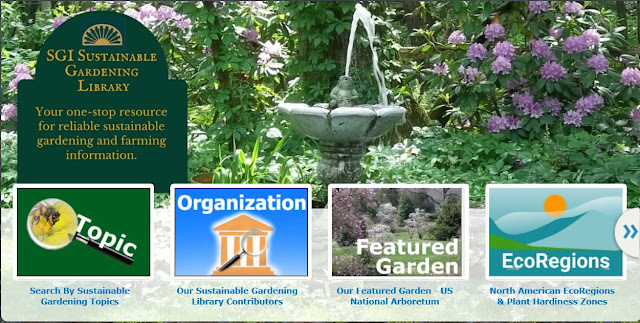
Sustainable Gardening Library Home Page
2. Preview the instructions on the Welcome splash page and click “OK.”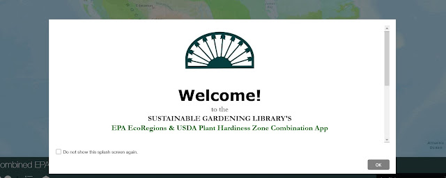
EcoRegions Welcome Splash Page
3. Pause for a moment while both map layers load. The layers contain a large volume of data, so loading time will depend on the speed of your internet service.
EcoRegions App Landing Page
4. Use the + icon to zoom in. Don’t skip this step – it enables the app to return more precise location data.
Zoom in
5. Pan, zoom, and click on the location of your choice. The
map will show an outline of the borders for the ecoregion(s) of your
selected location and a pop-up will appear with the name and code for
that ecoregion.


Choose your location

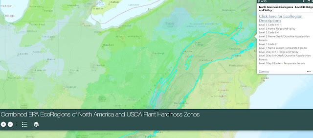
6. Click inside the popup for more ecoregion details. The link opens a pdf of the EPA’s Level III descriptions of the Ecoregions of North America, listed by code and name.
 |
| EPA Ecoregion Popup |
7. A second popup shows the borders of the USDA Plant Hardiness Zone.
 |
| USDA Hardiness Zone Popup |
Try This: To view the layers separately, click the layers icon to open the Layer List. There you can toggle the layers on and off as needed. You can view the map legends within the Layer List, or by clicking on the Legend icon (yellow arrow).
While navigation may differ, Smartphone users are able to access all of the features of the EcoRegions app.
Check us out at https://sgi-gardenlibrary.maps.arcgis.com/home/index.html
OTHER POSTS YOU MAY LIKE: How to Start a Sustainable Garden Without a Lot of Back-breaking Work
Like The Sustainable Gardening Library’s Page on Facebook
Follow The Sustainable Gardening Library on Twitter
 | |
| EcoRegions App Layers and Legends | |
While navigation may differ, Smartphone users are able to access all of the features of the EcoRegions app.
Check us out at https://sgi-gardenlibrary.maps.arcgis.com/home/index.html
OTHER POSTS YOU MAY LIKE: How to Start a Sustainable Garden Without a Lot of Back-breaking Work
Like The Sustainable Gardening Library’s Page on Facebook
Follow The Sustainable Gardening Library on Twitter